My companion and I set off at 12.00 noon on a beautiful day, determined to follow the original text as closely as possible, armed with an A3 photocopy of the map and a modern A-Z Guidebook, carefully ennumerating this Google Map:
… as we went along.
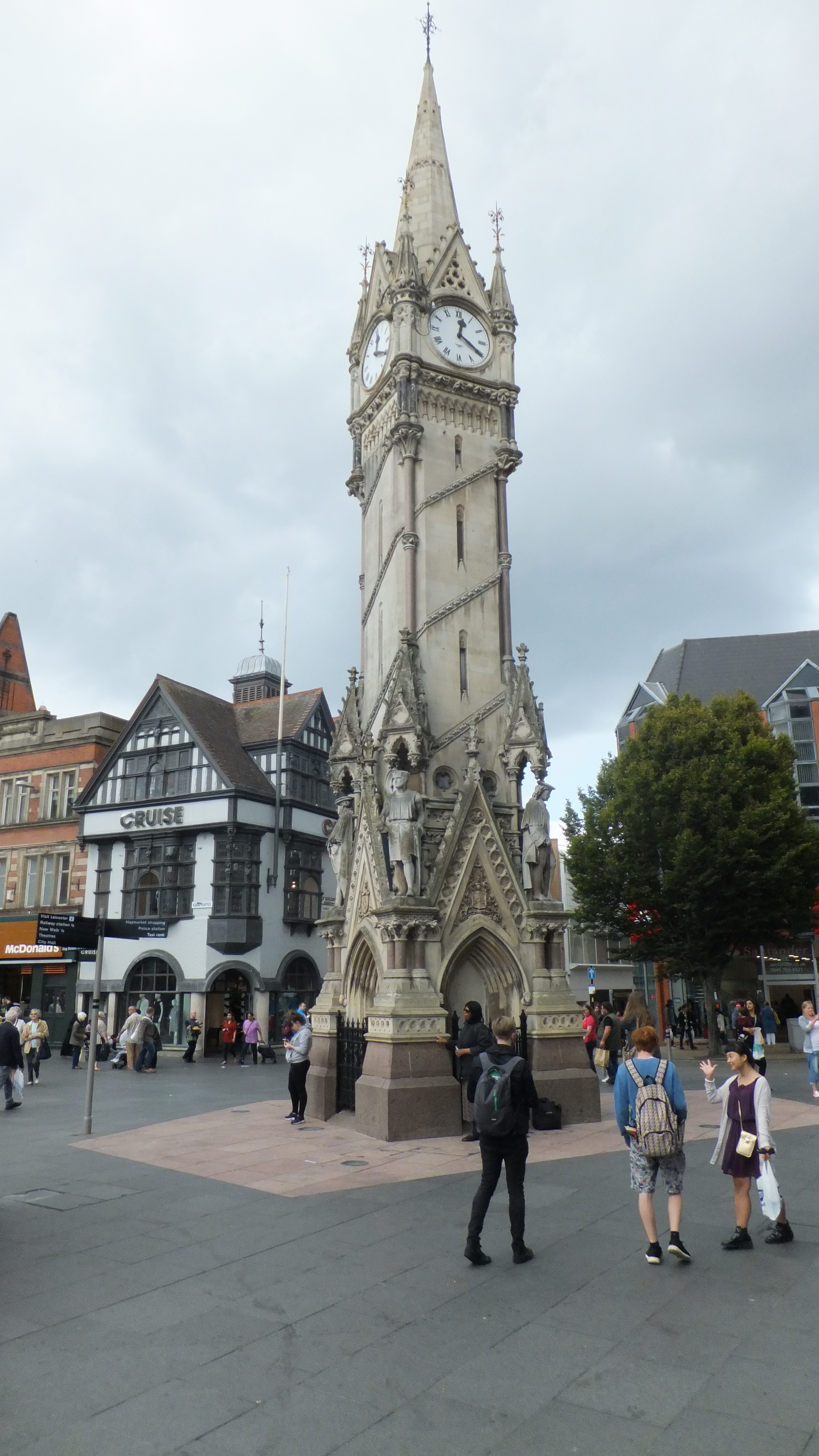
We set forward from the (1) Three Crowns Inn

(demolished in 1869 and replaced with the National Provincial – now National Westminster Bank building), along a strait wide street, called (2) GALLOWTREE-GATE, (corruptly pronounced Goltre), from its having formerly led to the place of execution, the left side of which is the scite of the antient city walls, speculating whether the snickets running towards the Market may have been old gates into the City.


At the bottom of this street, a building, formerly the assembly-room, but now converted to purposes of trade, with a (3) piazza, under which is a machine for weighing coals, forms the centre of five considerable streets:
We glanced to our right along (4) Humberstone Gate and walked up (5) Belgrave Gate, managing to avoid the worst of a brief summer drizzle under Vaughan Way Flyover and within a mile found here, among numbers of newly-erected dwellings (proofs of the increasing population of the town) is the (6) public and principal wharf on the navigable canal, near which is an iron foundery. This canal was formed, in consequence of a bill passed in 1791, for the purpose of opening a communication with the Loughborough canal, and through that, with the various navigations, united to the Trent. The line of the canal from Leicester to Loughborough is near sixteen miles in extent, and serves to supply Leicester with coal, lime, and the greater part of all the other heavy articles, which the consumption of a place, containing sixteen thousand inhabitants, requires.

We stopped by Leicester College to admire these (7) water-roads, as navigable canals may be termed, reflect the greatest honour on the ingenuity of man, exemplified in their formation, and prove most strikingly to the thinking mind, how boundless are the advantages of civilized life, and how inviolable the security afforded to property by laws, wisely framed and judiciously enforced.
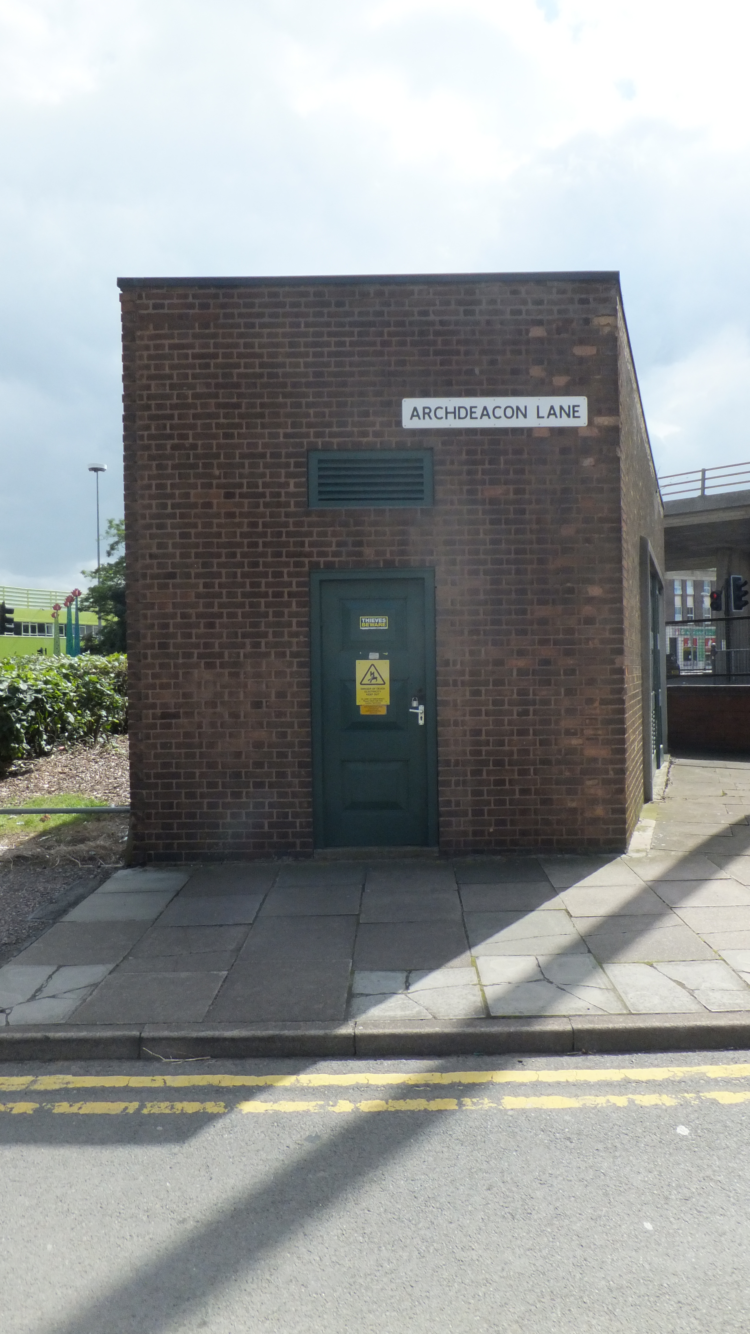
We walked back towards the City along a lane, called (8) Arch-deacon’s Lane, much changed in appearance but resolutely unchanged in name:
before arriving down a side-street and through a wooded glade to (9) ST. MARGARET’S CHURCH.

This structure is rendered venerable by its tower, whose pinnacles and trefoil-work, with the niche, or tabernacle, on the corner of the south wall of the church, would have even shown it, had not its date been confirmed by Bishop Alnwicke’s register, 1441, to have been the work of the era of the regular gothic.
We were bitterly disappointed; not by the well kept graveyard, nor the oasis of calm next to a busy road, but the (presumably Victorian) remodelling of the surrounds of the Church; no longer is to be observed of this and the other churches in this place, that the entrance is by a descent of several steps; a circumstance proving incontestibly, that the ground without has been considerably raised, since no reason could induce the founders of these sacred edifices to sink the floors beyond the natural level; nor is the surface of the church-yards alone, higher than the floors of the churches; so caused by the continued interment of the dead: but the general level of the pavements of the streets is also higher; from which it must be inferred, that the ground on which the present houses are built has been every where raised, and that very considerably. That the rubbish produced by buildings, and particularly the consumption of fuel, should produce this effect, is what any one may readily believe; and the Bishop of Llandaff calculates in his Chemical Essays, that the quantity of coal consumed annually in London, would raise an area of ten miles square, a full inch.
As the guide book advised, we saw nothing … worthy of observation in (10) Sanvey Gate. Walking south along (11) Church Gate we pass through an area of about an acre and a half, the property of Sir Nigel Gresley, Bart. now used as a wood yard; but formerly given by Queen Elizabeth to the freemen of Leicester, for the practice of public sports, and especially archery; whence, from the butts, or shooting marks erected in it, it is called (12) Butt-close.


There is good reason to believe that plots of ground were once destined to the like purposes in almost every village, and butts erected for the practice of that art, to which several of the most important victories of the English were certainly owing. We gave particular thanks on this walk in this year, just past the six hundredth anniversary of the battle of Agincourt.
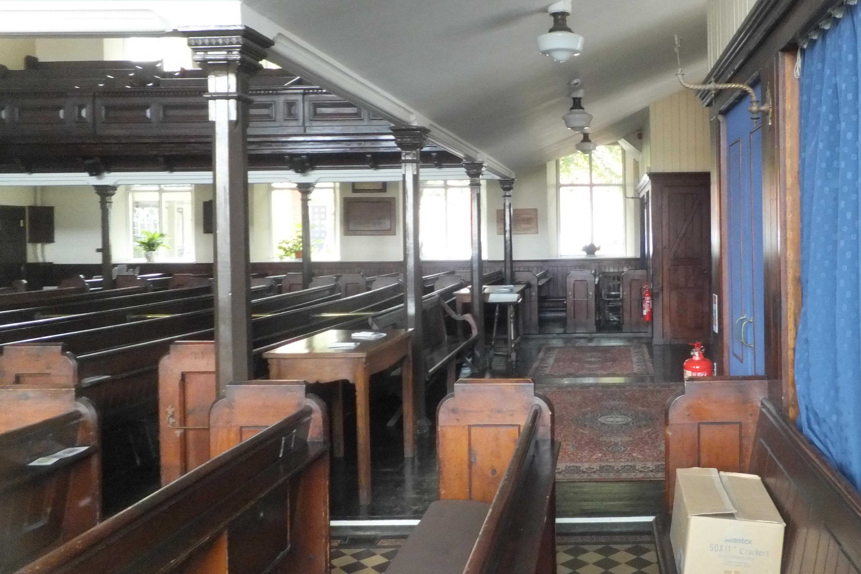
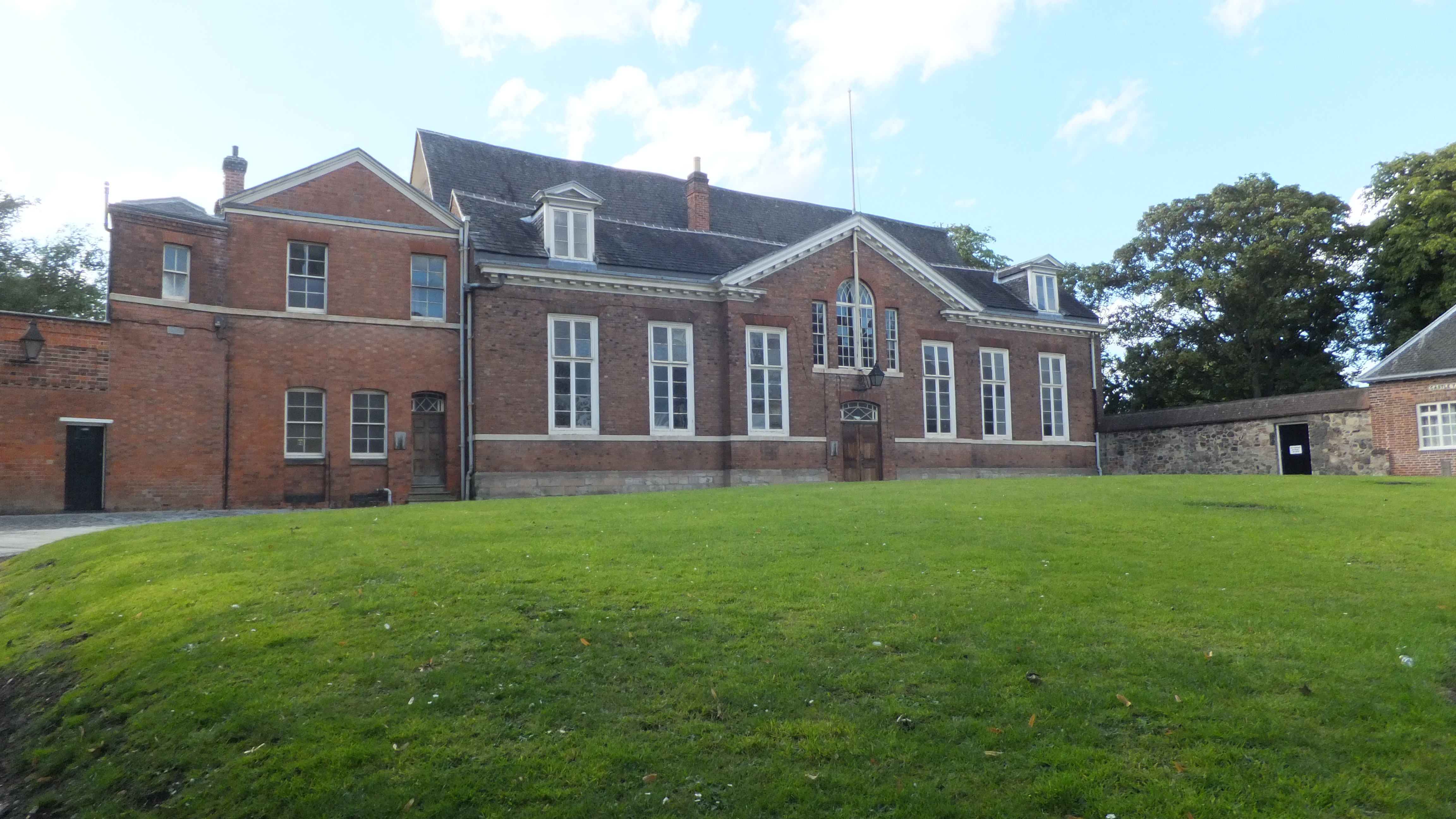
Crossing the Butt-close, to the alley on the right, we pass the Presbyterian, or (13) Great Meeting House, built, as appears by a date on the walls, 1708; the congregation of which was first established in 1680. The seats are calculated to accommodate eight hundred persons. Unable to gain access, we were able to admire the Georgian interior (hopefully not being taken for prospective burglars):


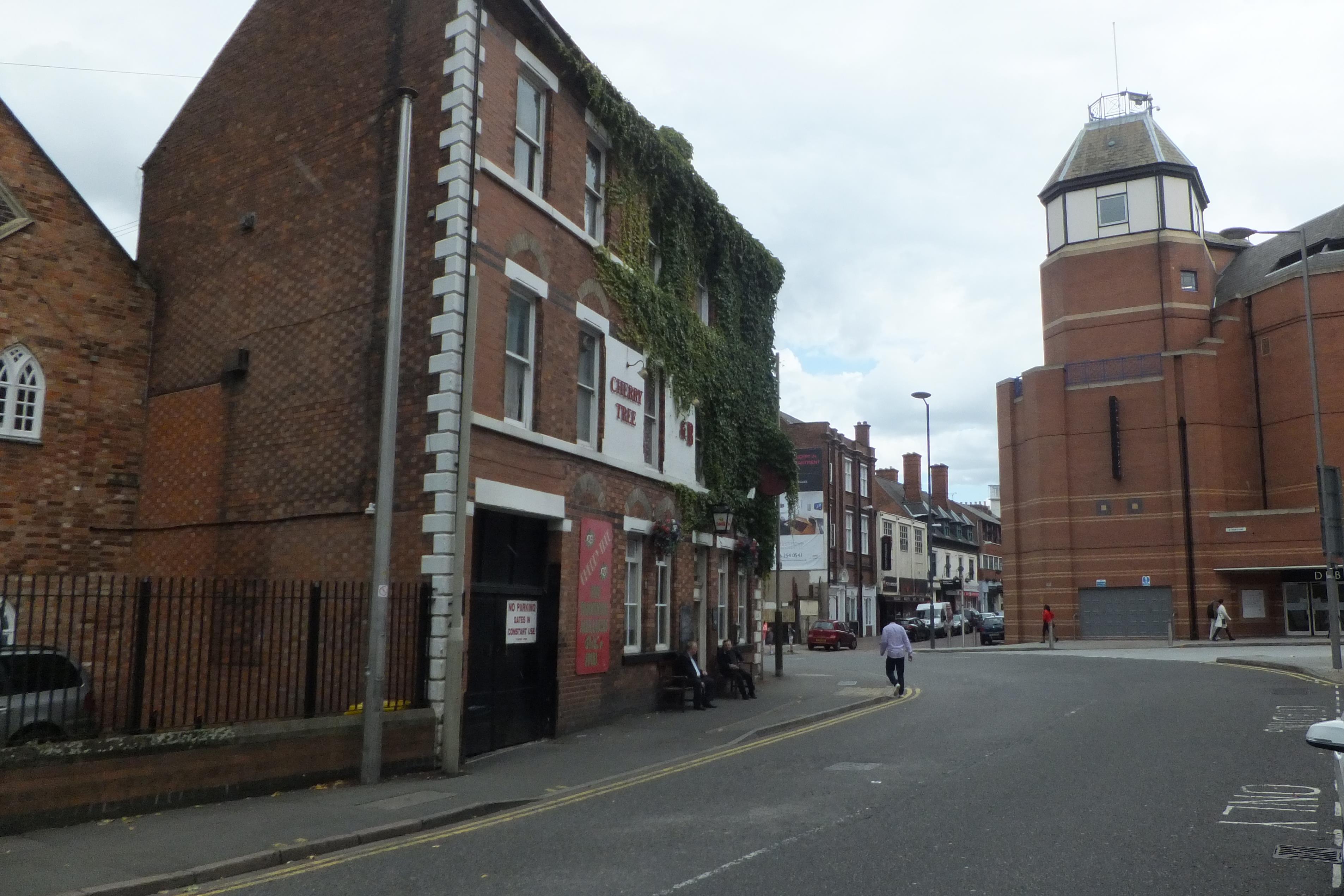
From the Great Meeting House we pass an irregular street, now called the (14) SWINE MARKET, formerly Parchment Lane; which may afford interest to the mind tho’ not to the eye; for the reflective Traveller will not regard as unimportant the humble dwellings of those Manufacturers whose industry supplies the commercial wealth of the nation. Although the City Fathers clearly considered the name Swine Market lacking in sophistication (understandable, I suppose; but what was wrong with Parchment Lane?) and renamed it not once, but twice, they couldn’t straighten out the road, now Bond Street; the kink in the route dodges past the Cherry Tree Inn.
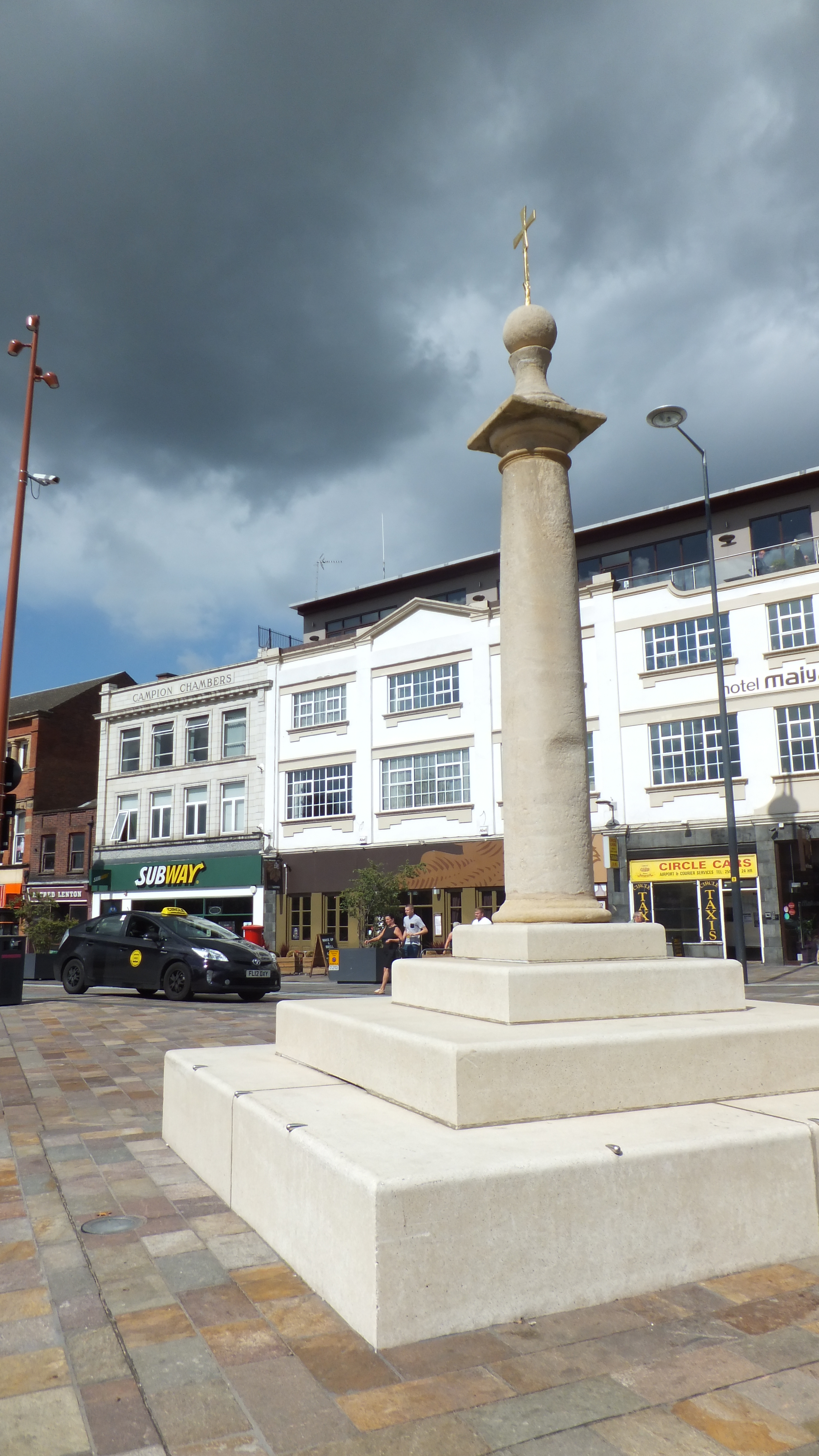
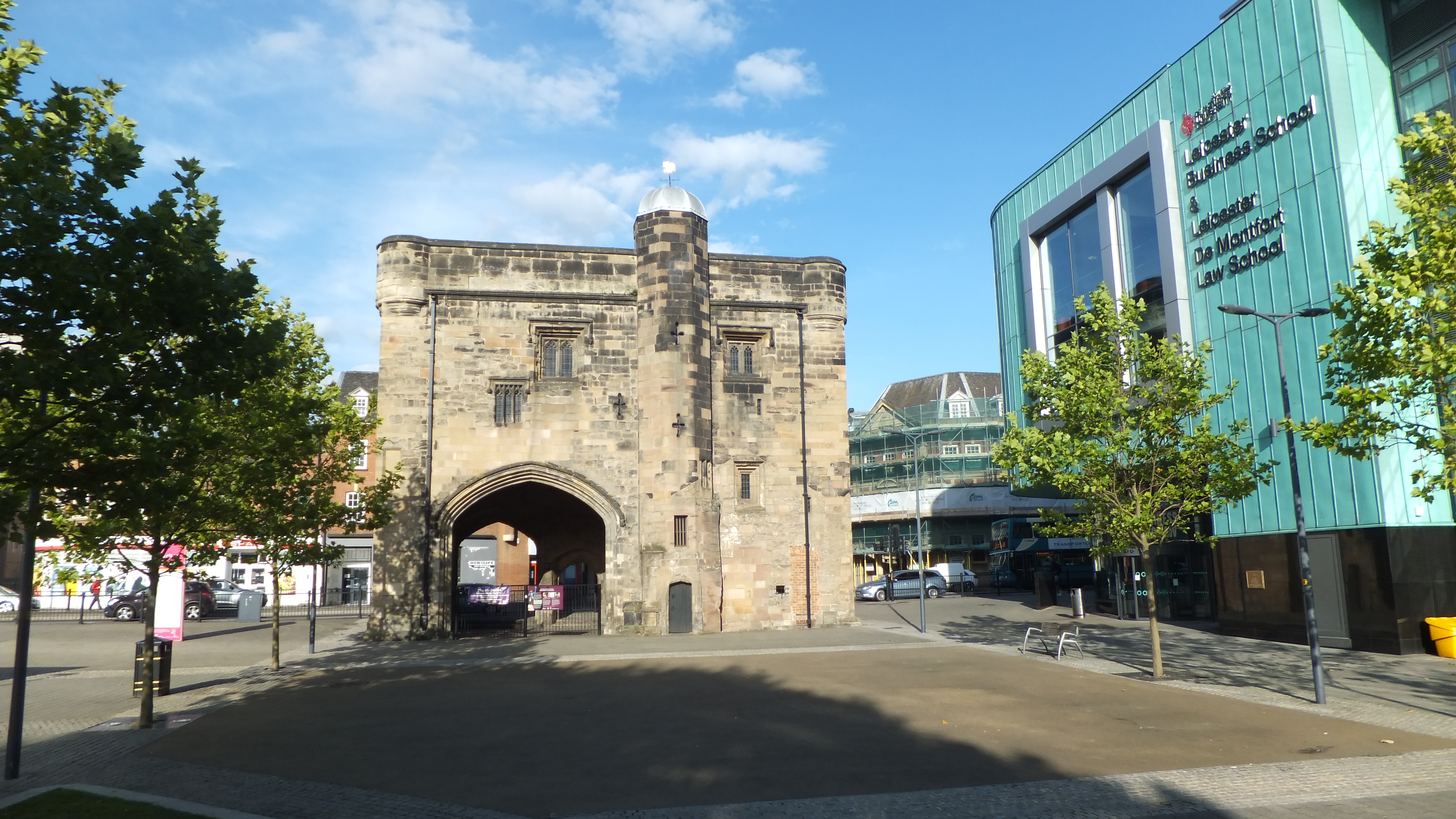
Lunch was had at James’ Cafe Bistro on East Bond Street – excellent – a small independent place. A sandwich and a cup of tea always tastes good, and all food always tastes better after a good walk. At the bottom of (16) HIGH-CROSS-STREET, from a plain doric pillar bearing the name of High Cross, and which formed some years ago one of the supporters of a light temple looking building of the same name, that served as a shelter to the country people who here hold a small market on Wednesdays and Fridays for the sale of butter, eggs, &c. we admired the (relocated) new High Cross:
Walking north, we spotted, separated from the county prison, by a lane called Free-School Lane, is a rude heavy building, adorned with the Royal Arms. This is the (18) Free Grammar School, the æra of whose original foundation has been thought uncertain; but upon the authority of the learned topographer Leland, it is ascertained to have been founded by one of the three Wigstons interred in the collegiate church in the Newark, and who, according to the same writer, was a Prebendary of that church.

The next object that engages the eye is the church of (19) All Saints, projecting on the west end into the street, exhibiting in its clock an humble copy of the machinery of St Dunstan’s, in London. It is a small neat church with three aisles and a low tower, and nothing in its architecture attracts regard, apart from a fine Norman door arch.

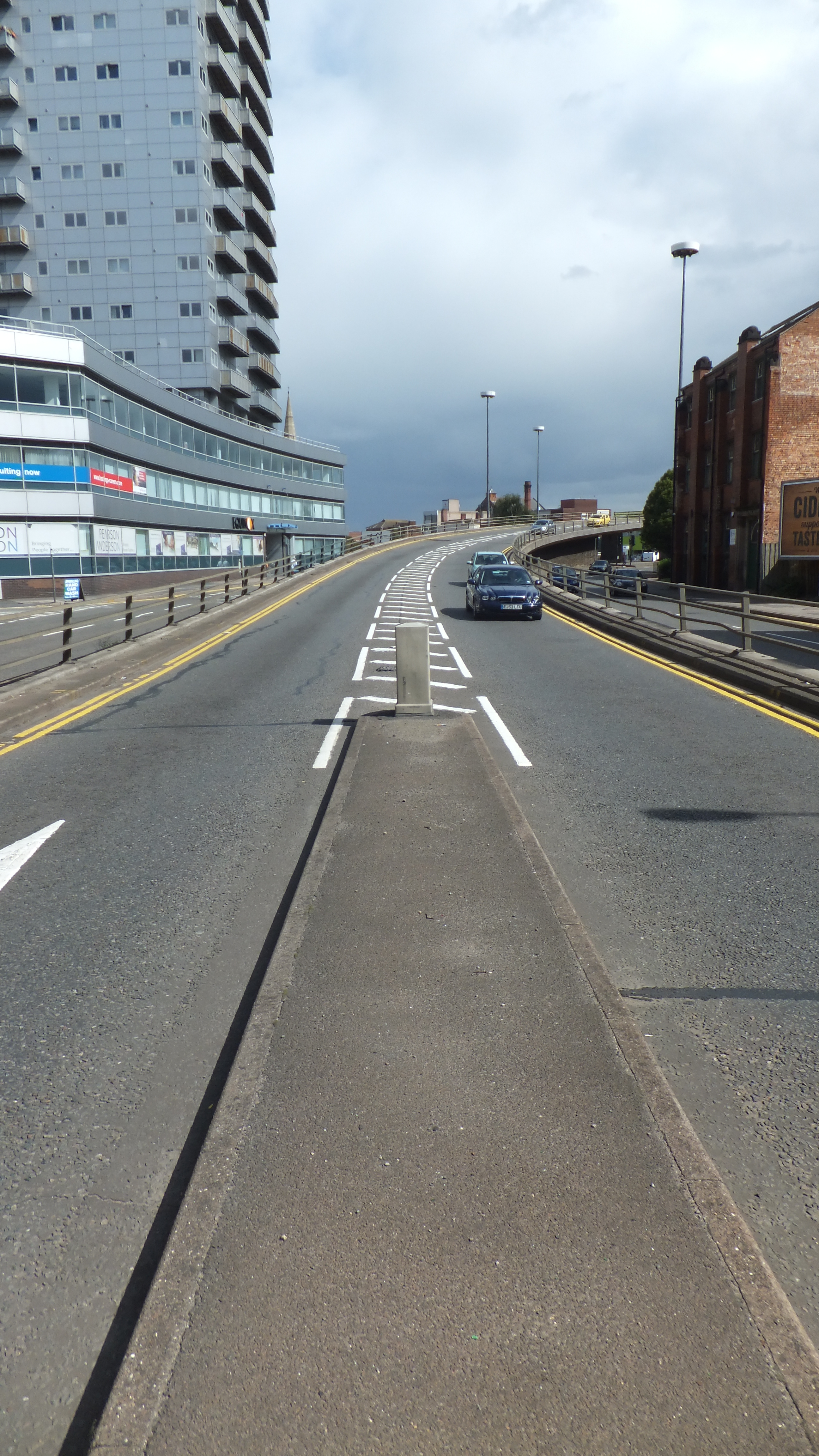
The street continuing in a right line, now takes the name of NORTH-GATE STREET, and conducts us to a bridge over the Canal, beyond which is the (20) North or St. Sunday’s Bridge. This is an elegant stone structure, erected in 1796 and when viewed from the Abbey meadow below, it forms with the trees and slopes beyond it a very pleasing scene.

At the foot of the bridge in an area enclosed by a low wall, and distinguished by a few scattered grave-stones, the church-yard of (21) St. Leonard meets the eye. The church, of which no trace remains, was demolished by the Parliament Garrison in the reign of Charles the first; as from its convenient situation it might have covered the approach of the enemy, and given them the command of the bridge. It was rebuilt in 1876, consecrated in 1877, and demolished for a second time in 1983. I used to be driven past it on family trips to Bradgate Park. Once again, as in 1804, no trace remains.
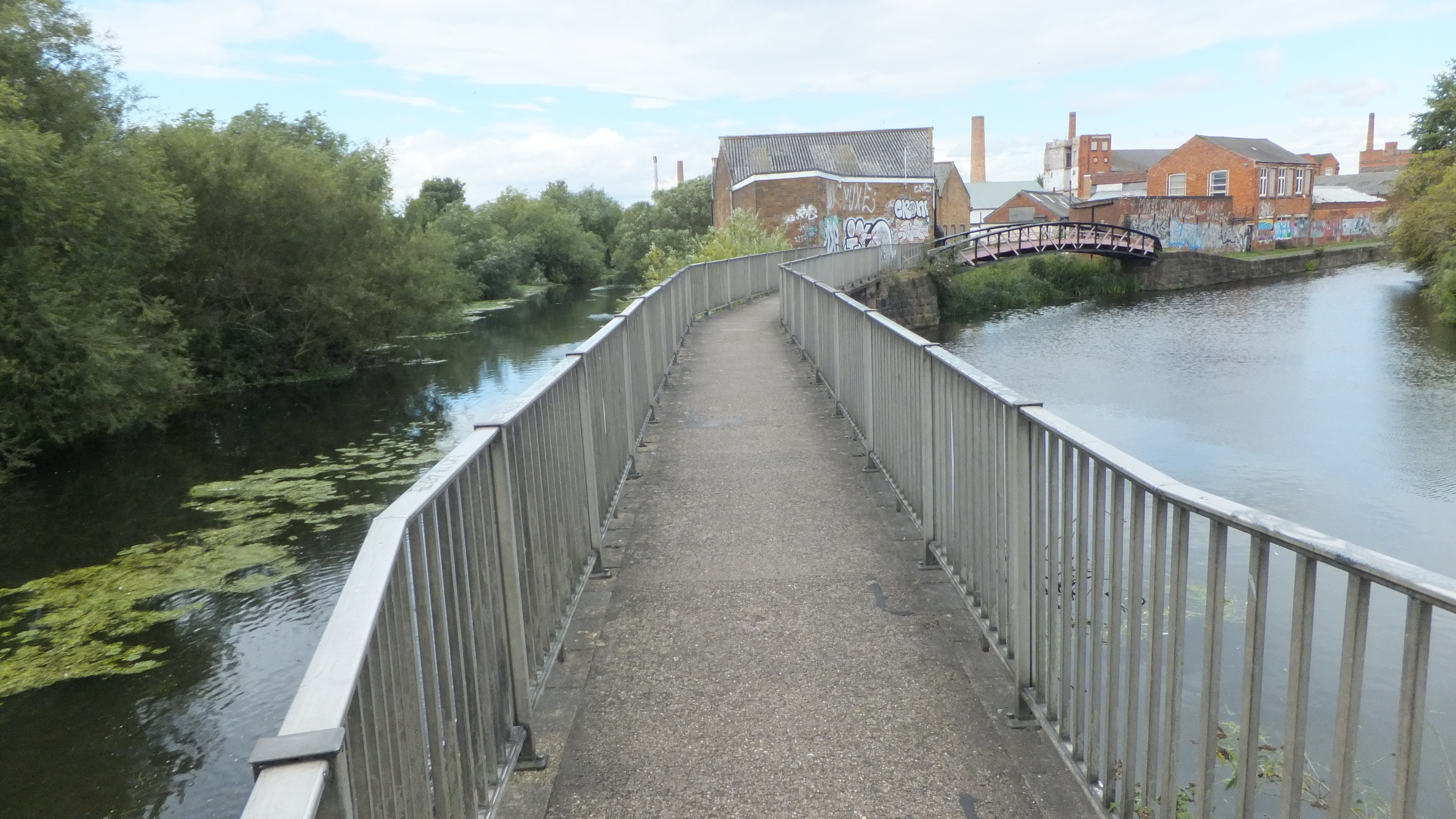
Cutting back down North Gate and turning east along the canal, we came out to the River Soar and turned south. The sweeps of the river which here beautifully meanders, wash, almost closely, a large extent of town, affording an agreeable prospect on the left, and a slope finely diversified with groves and pasturage descends gently to the meadows on the right.
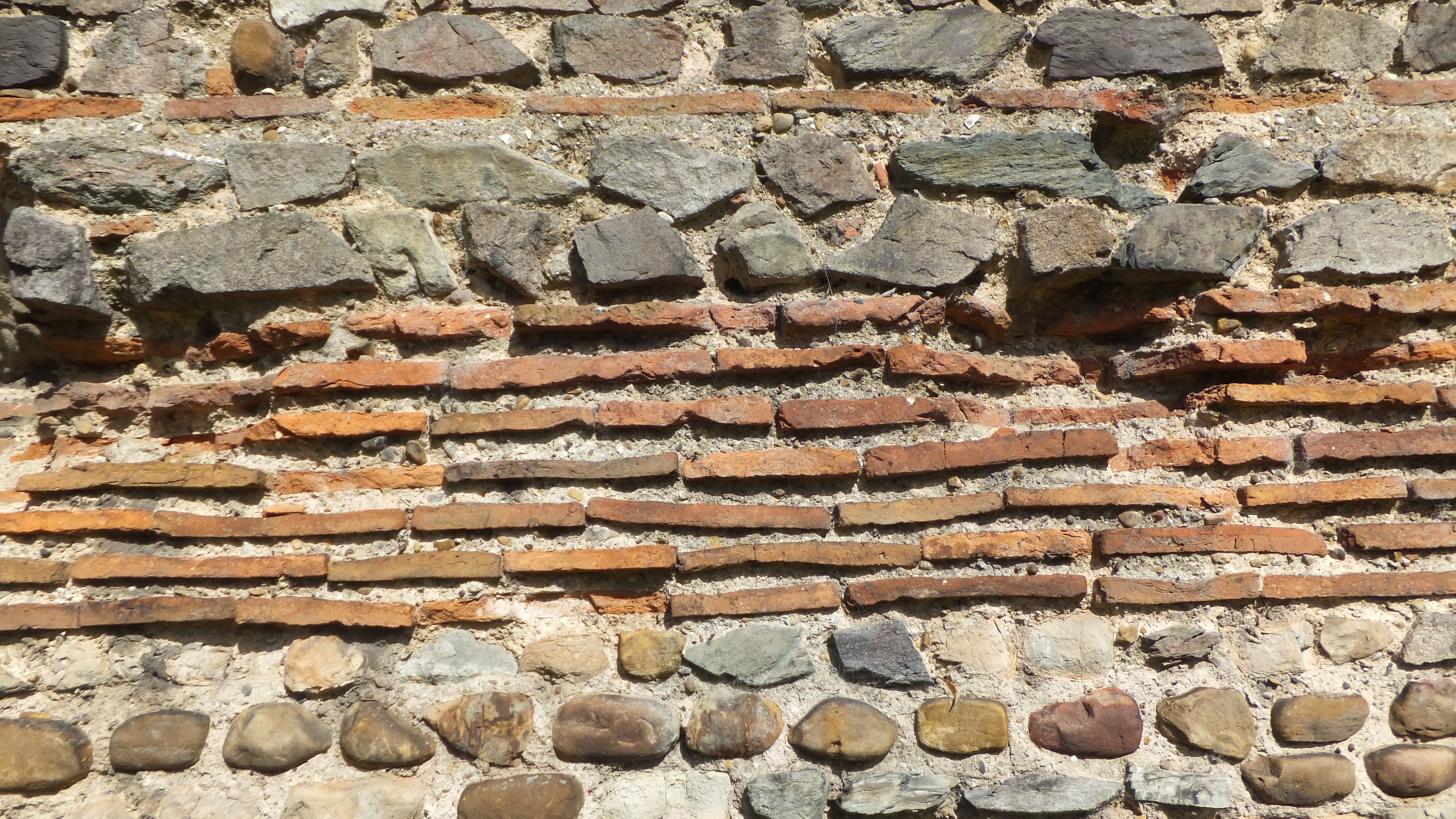
After dodging the traffic, we are now arrived at an object which brings them more forcibly to remembrance, a massy arched wall, commonly termed, from its bounding the quarter antiently inhabited by the Jews, the (25) Jewry Wall… If, however we must indulge a conjecture, we shall be led to imagine, from the slight remain of ornament, which is only the fragment of a niche, that this wall was either part of a Roman temple or bath:

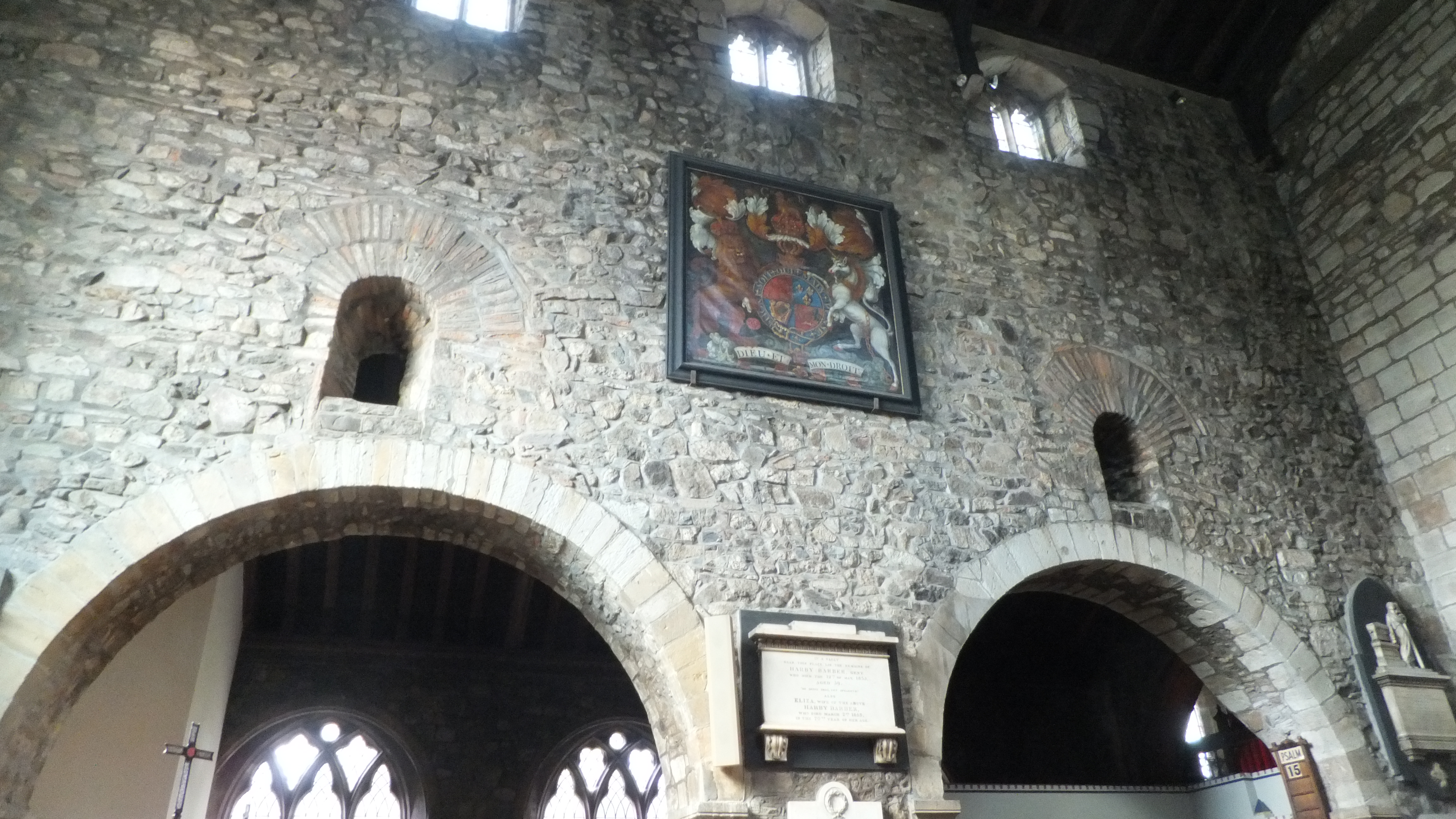
The adjoining church of (26) St. Nicholas is a small edifice of very rude and consequently very antient construction. It has evidently been built at different periods. It consists only of two aisles, the north one having long since been taken down; the south aisle is gothic, and the other, properly the nave, is of that massy unornamented style, in use before and at the conquest; from the circumstance of its being built with the materials of the neighbouring Roman work, it will perhaps be no anachronism to assign to it a date prior to that period. The tower is also Saxon; and the spire having been damaged by the wind is now taken down.

Rude it may have been; but by a piece of good fortune the Church was open. We received a short, impromptu organ recital, and my travelling companion was allowed to ring the bells. What time passers by thought it was we did not enquire.

A short distance away (via the calm of the Castle Gardens, rather than the danger of Southgates Underpass) we soon had a full view of (27) St. Mary’s church,
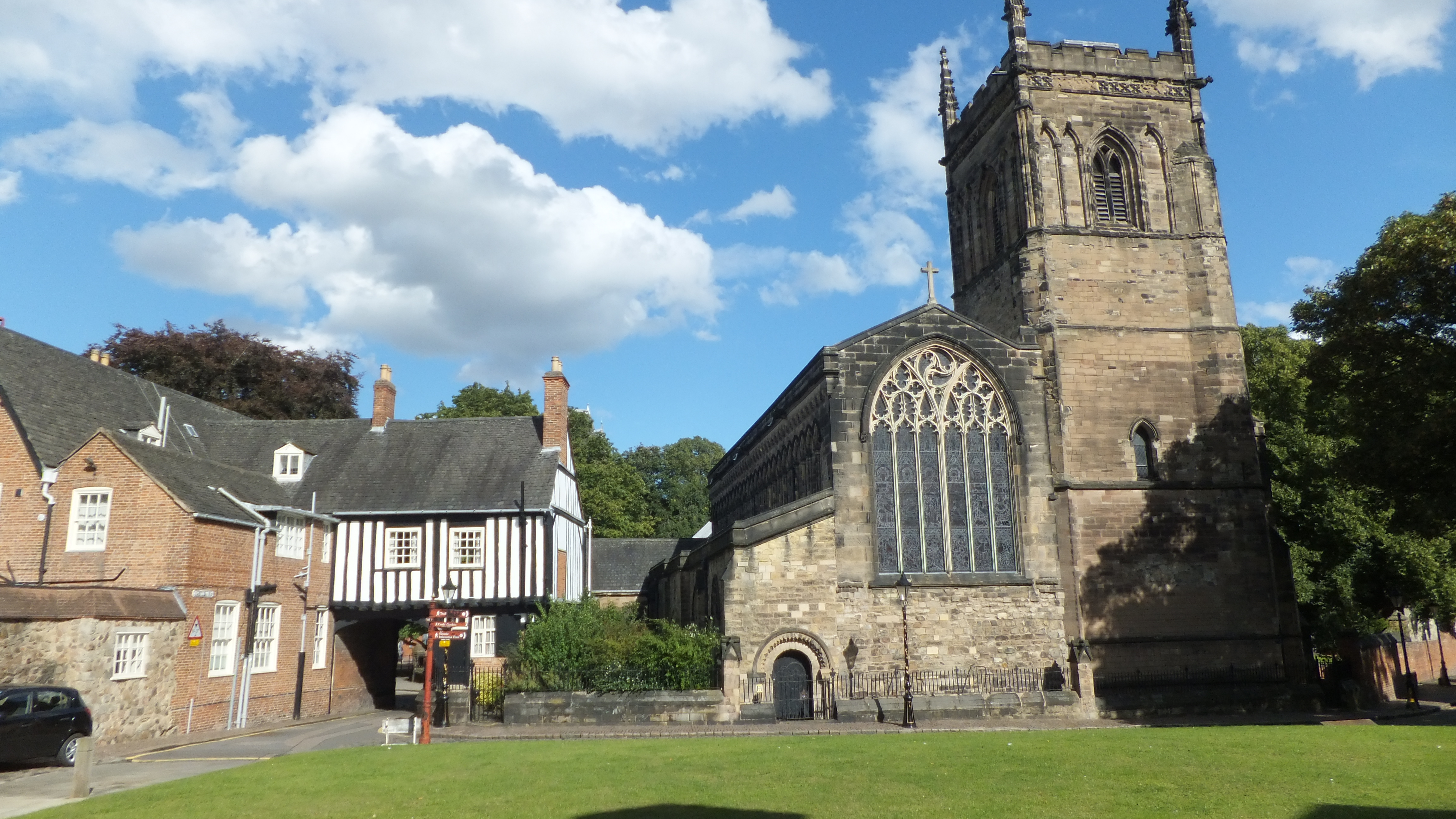
antiently known by the distinguishing addition of infra or juxta Castrum, a building in which he will perceive, huddled together, specimens of various kinds of architecture, from the Norman gothic of the north chancel, to the very modern gothic of the spire; a mixture which evinces the antiquity of the church, marks the disasters of violence, accident, and time, and proves that the neighbourhood of the castle, within whose outer ballium or precincts it stood, was often most dangerous.
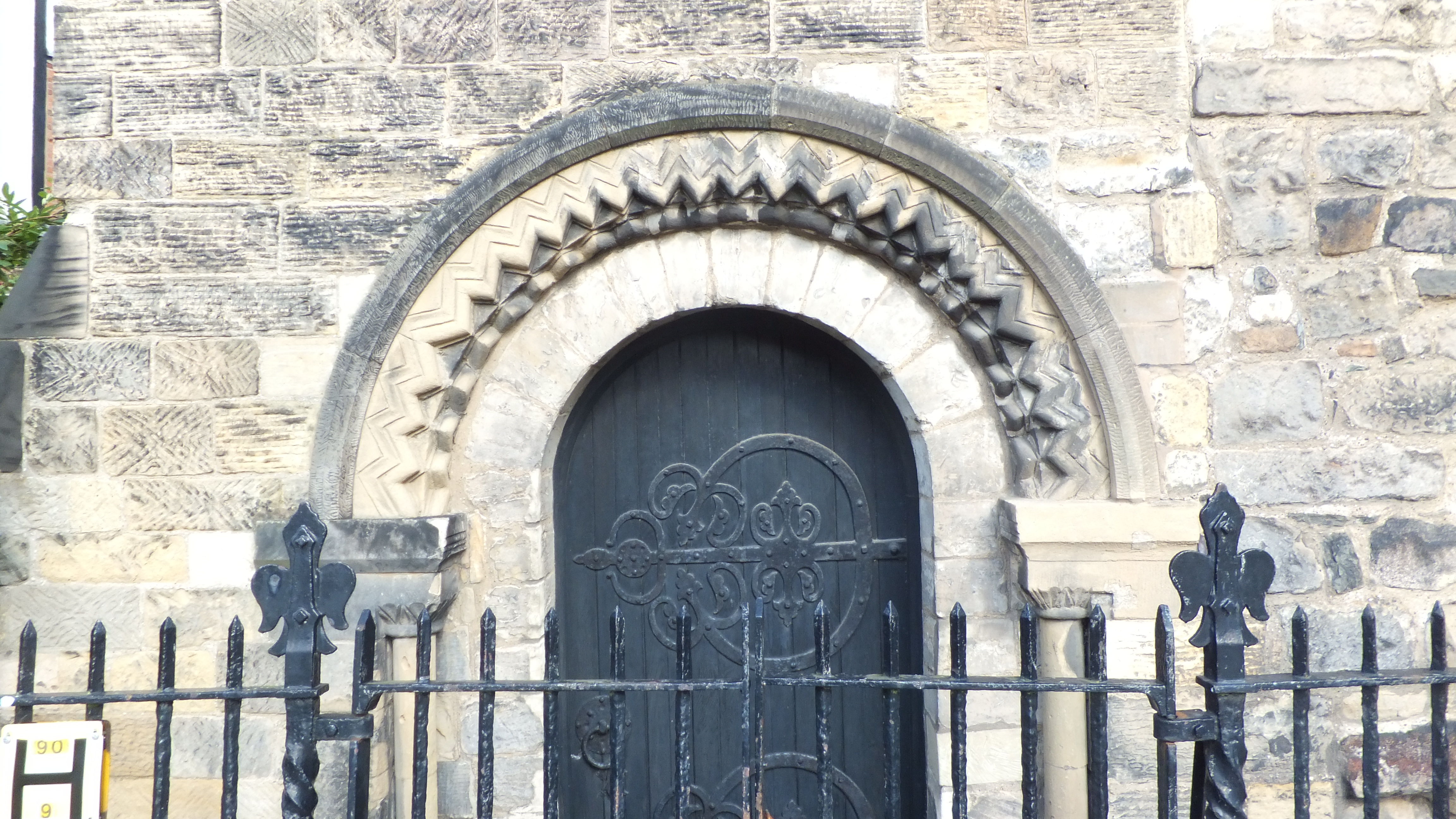
It’s no wonder it took me a long time to really appreciate history; any small child or bored teenager isn’t going to be impressed by (28) Leicester Castle. Opposite … stands a building most probably erected by the first of the Bellomonts, tho’ the modern front which meets the eye effectually conceals all the outward traces of antiquity.
The inside of the edifice however is a room exceedingly curious. Its area is large, being about seventy-eight feet long, twenty-four high and fifty-one broad. It is framed into a sort of aisles, by two rows of tall and massy oaken pillars, which serve to support a large and weighty covering of slate. This vast room was the antient hall of the castle, in which the earls of Leicester, and afterwards the dukes of Lancaster, alternately held their courts, and consumed in rude but plenteous hospitality, at the head of their visitors, or their vassals, the rent of their estates then usually paid in kind.
From the county hall, or castle, as it is commonly called, a road to the right leads to an (29) antient gate-way strongly built and once furnished with a port-cullis, and every requisite for defence.
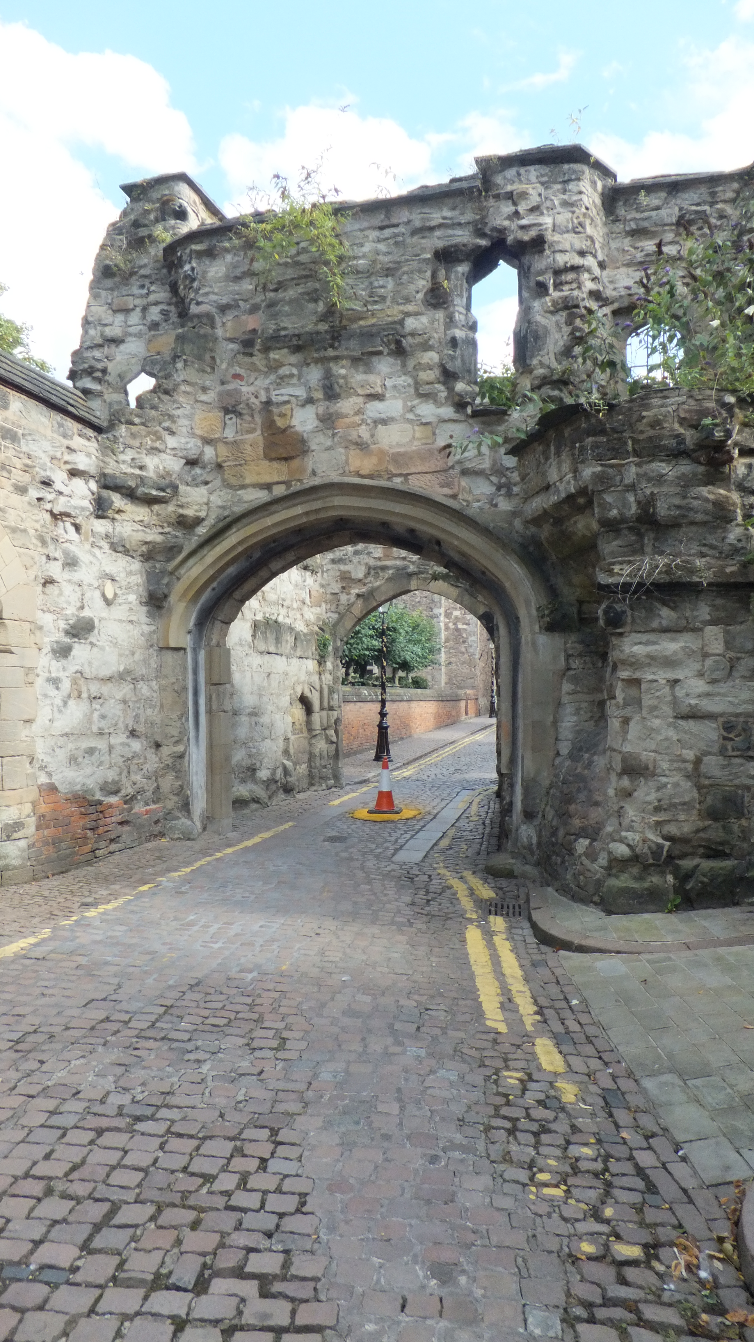
… passing thro’ the south gale-way of the castle yard, the visitor enters a district of the town called the Newark, (New Work) became the edifices it contained were new when compared with the buildings of the castle…

…Indeed if the state of England during the age of the founders be considered, magnificence rather than great strength might be expected to be their object, and magnificent truly were the buildings of the Newark. The gate-way now known by the name of the (30) Magazine,
from the circumstance of its being the arsenal of the county, is large and spacious, yet grandly massive; and the form of its arches, which partake of the style of the most modern gothic, tho’ built at the time when, according to the opinions of the most learned Antiquaries, that truly beautiful species of architecture was not generally established, prove the ready attention of the founders to the progress of the arts.
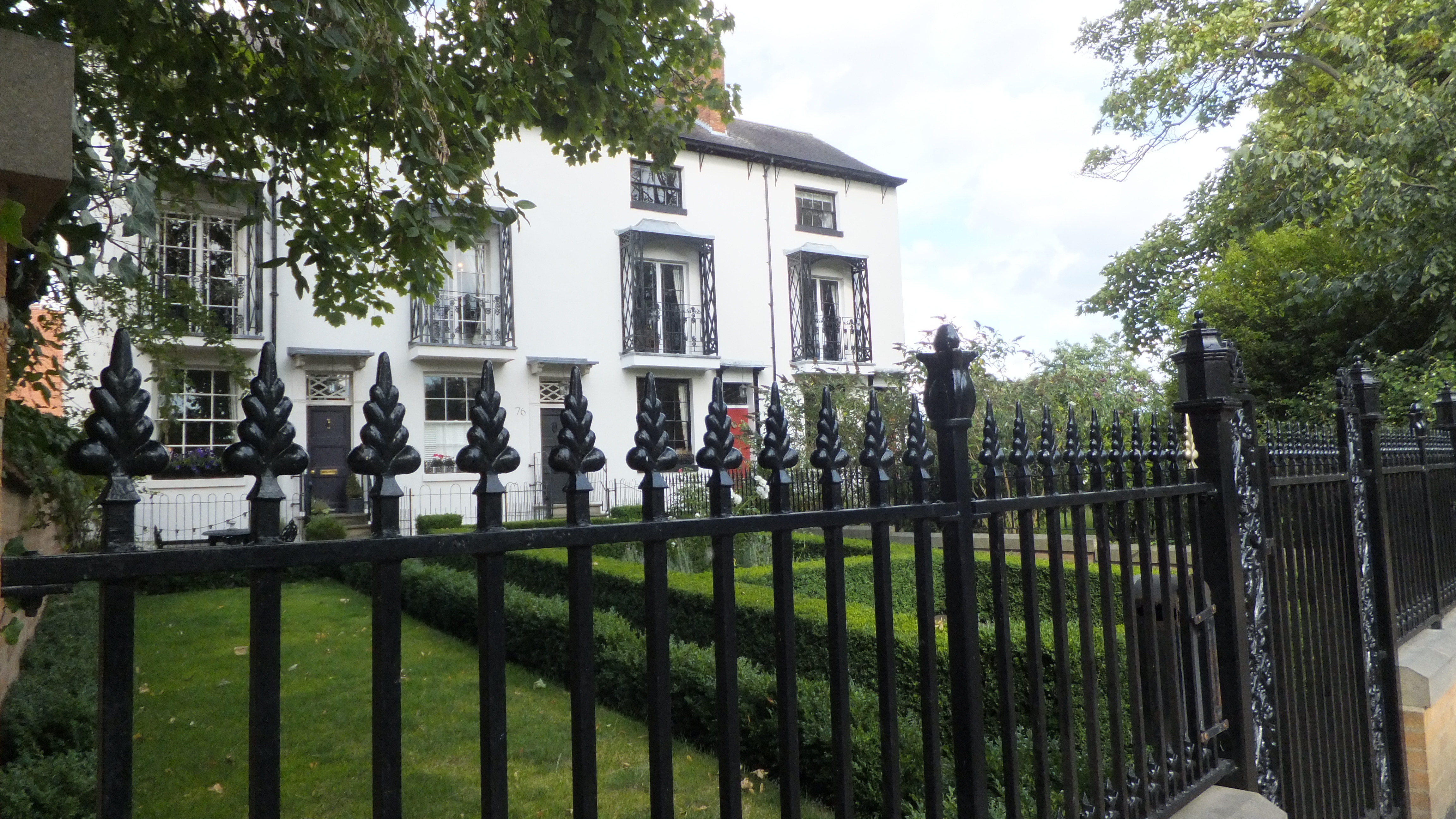
We walked south, following the map along Grange Lane, as the working day drew to a close. At the end of this street, situated on a gentle eminence affording the desirable advantages of a dry soil and open air, we perceive one of those edifices which a country more than nominally christian must ever be careful to erect, a house of refuge for sick poverty. (32) The Infirmary, which owes the origin of its institution to W. Watts, M. D. was built in 1771, nearly on the scite of the antient chapel of St. Sepulchre, and is a plain neat building with two wings, fronted by a garden, the entrance to which is ornamented with a very handsome iron gate the gift of the late truly benevolent Shuckbrugh Ashby, Esq. of Quenby.

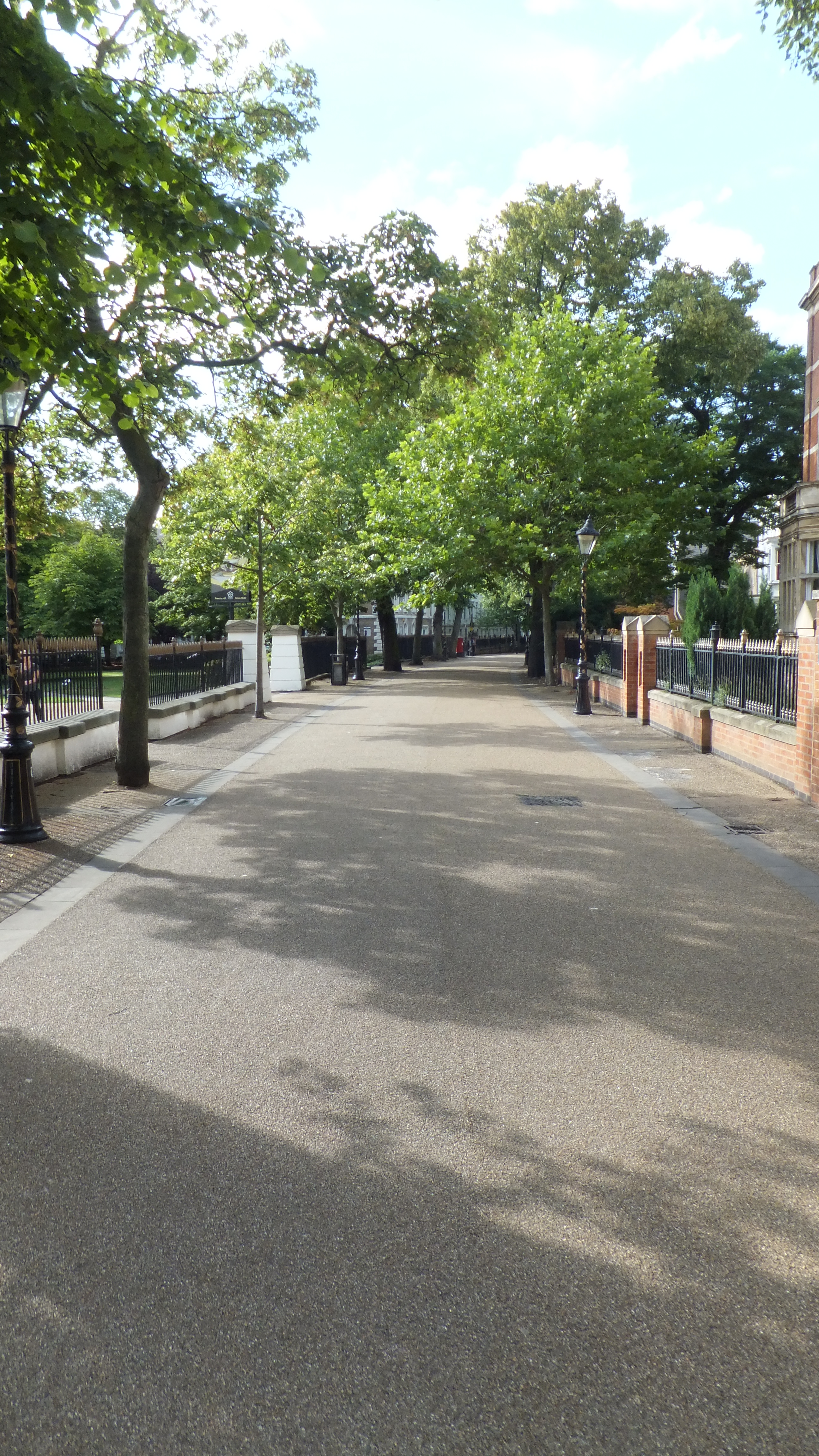
From the Infirmary, if the visitor wishes to close his walk, he may enter the town by the (35) Hotel; if he feel inclined to extend it, he will find himself recompensed by the pleasure his eye may receive from a lengthened stroll up the public promenade, called the (33) New Walk. We felt so inclined, and were not disappointed. This walk three quarters of a mile long, and twenty feet wide, was made by public subscription in 1785; the ground the gift of the corporation.
Emerging by the Victoria Park gates, at the advice of the guide, we looked north along London Road and saw a view we’d never noticed before. The guide advised that, returning by the (34) London toll-gate if the traveller wishes to obtain a full view of a fine prospect, he will turn aside from the road, and mount the steps of one of the neighbouring mills. From such a station the clustered buildings of the town extend before the eye in full unbroken sweep; beyond it the grounds near Beaumont Leys varied in their tints by tufted hedge-rows, and streaky cultivated fields, blend into the grey softness overspreading those beautiful slopes of hill into which the eminences of Charnwood forest, Brown-rig, Hunter’s hill, Bradgate park, Bardon and Markfield knoll, rise and fall.

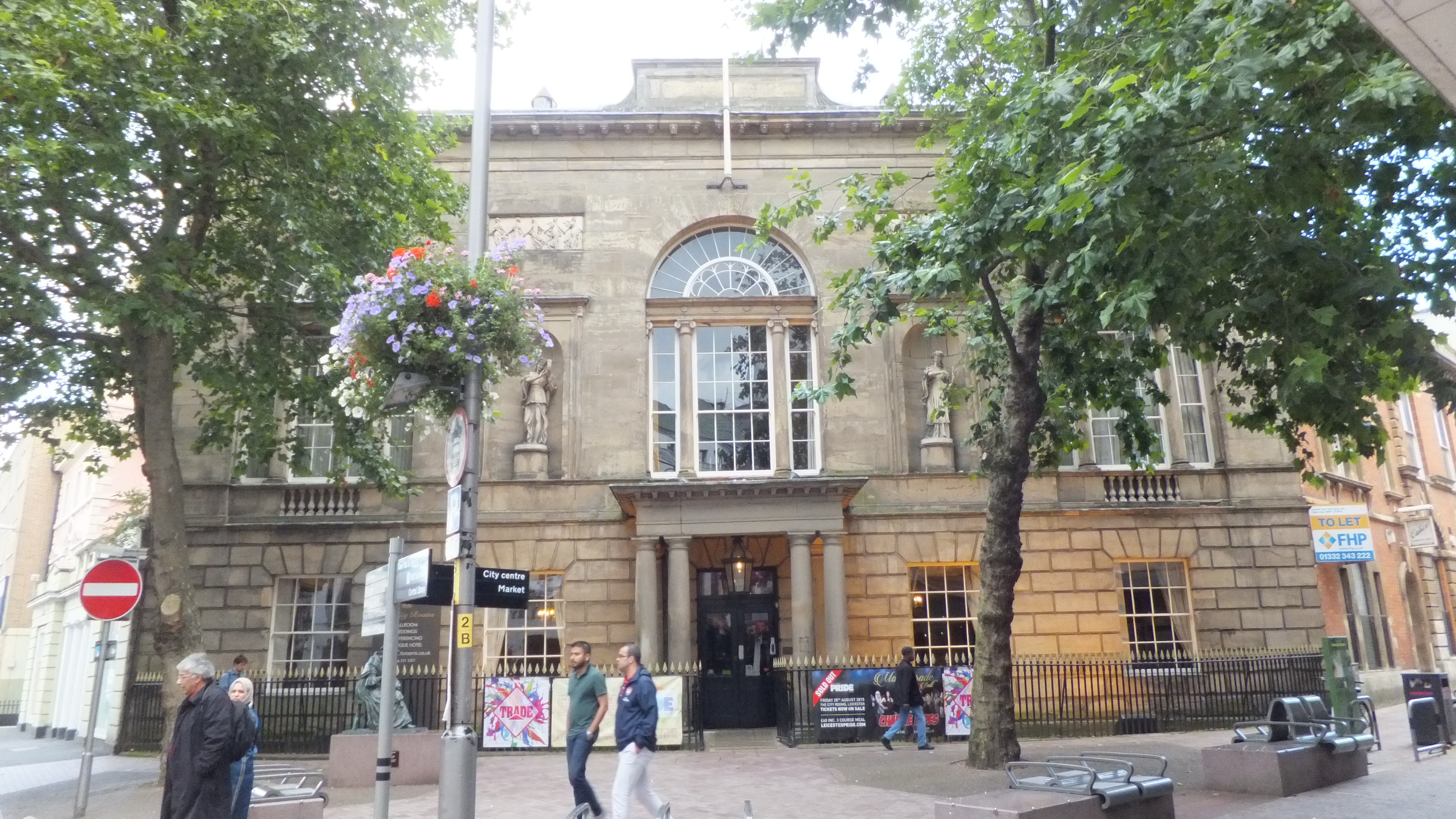
Back in the City after a Greggs Vegetable Pasty (disaster – no cheese and onion!), we saw the front of the (35) HOTEL, which name it bears, having been originally designed for that purpose, may from the grandeur of its windows, its statues, bassi relievi, and other decorations, be justly considered as the first modern architectural ornament of the town. Never a success as a Hotel, it was rebranded first as the Assembly Rooms; then as the County Rooms; and now, having come full circle back to a Hotel, as the City Rooms.
Passing down the New Street,
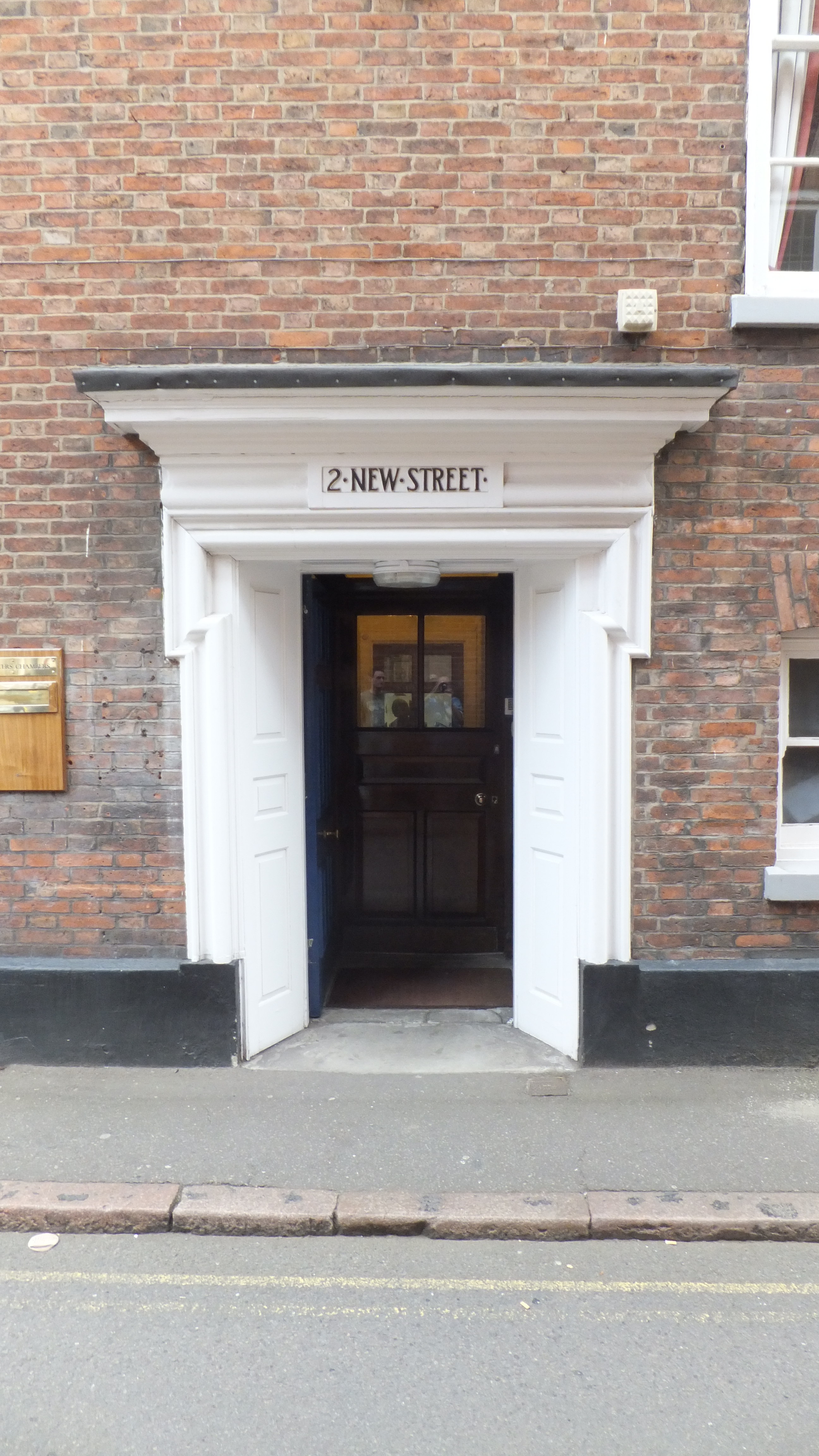
part of the scite of the monastery of the Grey Friars, we arrive at (36) ST. MARTIN’S CHURCH

at what period after the demolition of Leicester in the reign of Henry the second, the church of St. Martin, antiently St. Crosse, was rebuilt, cannot be accurately stated. If it was unclear to our guide, it’s fairly obvious now; after a typically heavy handed Victorian ‘restoration’ and south porch addition, it might as well be 1875.
Carefully circling the church clockwise,

we came across the (37) hall formerly belonging to the guild or fraternity of St. George, which, together with the Corpus Chrisri guild, the principal establishment of that kind in the town, was founded in St. Martin’s church, was purchased, on the dissolution of guilds and chantries by the corporation, and is the guild-hall of the borough.
Wearily we retraced our steps along St Martins’ Lane and Hotel Street, before coming into the (38) MARKET-PLACE.

In this spacious area, which is surrounded by handsome and well-furnished shops, and whose public ornaments are the plain but respectable building called the Exchange, built in 1747 (and demolished in 1854 and replaced with the Corn Exchange) where the town magistrates transact their weekly business, and a small octagon edifice enclosing a reservoir of pure water, the Conduit, erected in 1709, we must, having completed the circuit of the town, offer our farewell to our visitor. A little footsore – it was now 6pm – we returned home.
